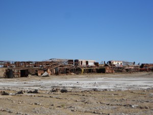
When Sarah last left you, we had just finished our tour of the Uyuni Salar, one of our favorite experiences in South America. Before moving on to La Paz, we decided to take a rest in Uyuni for a day, partly because we were tired after the tour and partly because our friend Trung told us that this tiny high dessert town was also home to the largest plastic bag cemetery in the world. He was right, but he neglected to tell us that Uyuni is also the place where dust goes to die!
Anyway, we spent a day planning the rest of our stint in Bolivia and contacting the outside world on the slowest internet connection on the planet; this in itself actually doubled as entertainment as some of the more spoiled tourists in town pounded their fists and shouted obsenities in the internet cafe. I’m not sure how they expected fast internet in a town in the dessert at almost 3700 meters where not even dust could survive, but I made sure to nod my head with stern indignation whenever they looked over at me in disgusted disbelief at our horrid situation. 🙂
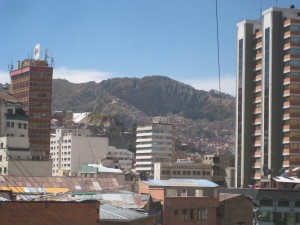
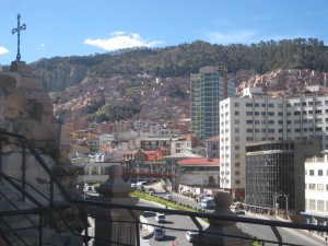
We took a tourist night bus into La Paz; I know that our bus experiences have been memorable as our trip has gone on, but we have officially declared ourselves wily veterans of the local buses and decided that we would splurge on a bus that had heat and also discouraged its drivers from drinking on the job. It was a good decision because we both slept well on the journey while also making it to La Paz alive the following morning. Coming into La Paz was actually pretty spectacular as the highway runs high above the city, overlooking large steep cliffs that surround it. At 3,660 m (well over 11,000 ft), La Paz is the world’s highest capital, and much of it is literally built on the sides of high cliffs reaching up into thin air.
Sarah and I spent most of our first day in La Paz getting set for some of the other things we wanted to do in Bolivia and also taking advantage of being back in a city where we could resupply on a few necessities. Wondering in the capital is a tiresome deal; not only is the altitude a killer, but the sun is also a lot hotter here than we were used to, and the tall buildings held in the heat. After walking up a particularly steep hill, both Sarah and I plopped to the ground to catch our breath and cool our burning lungs. I was a little surprised to be struggling with it after a week in Bolivia, but we hadn’t really done a whole lot of walking since we’d been at the higher elevations. Remembering our motto on Mt. Kilimanjaro, the Raff’s began to move pole, pole!
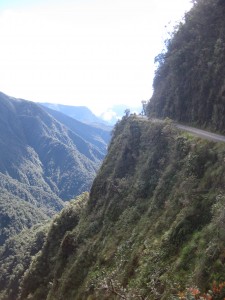
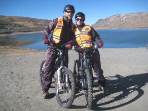
The highlight of our time in La Paz occurred the next day when we took the bicycle journey down The World’s Most Dangerous Road (WMDR). Once the main road for traffic from La Paz to the busy tourist town of Coroico, this road had at one time averaged a fatality every other day. The company that we had chosen to ride with, Gravity Tours, was the originator of biking the road back in 1992, and the ride has become infinetesimally safer in the past few years because they have built a new paved highway to replace the narrow, winding gravel road that once held two-way traffic, in addition to kamikaze bikers. Still, we would be zooming down a 63 km road that began at 4700 m and ended at 1200, for a drop nearly the size of going from sea level to the summit of Mt. Hood. Pretty awesome!
After meeting up with everyone at a cafe that I am pretty sure the owner of the biking company also owned (their brochures plug about a dozen restaurants, bars, and hostels that rumor has it all share the same owner), we left La Paz for a 45 minute bus ride up to La Cumbre, our mountainous starting point on the edge of a pretty lake. We were surprised to find that our guide was from Tacoma, Washington, and had actually played football against Battle Ground High School during my second or third year teaching. He was a climber, and it was fun to talk with him along the way.
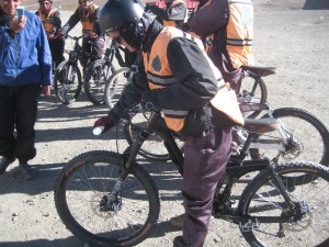
We had a brief safety lesson at La Cumbre and then performed a ceremony to Pacchu Mamma (sort of like Mother Earth) in which we basically asked her for a safe journey by pouring a bit of alcohol on the ground (he specifically noted that this was not for dead homies), on our tires, and then just a swig down our gullet. With that formality out of the way, it was time to ride!
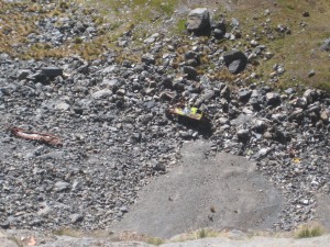
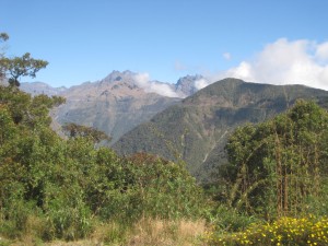
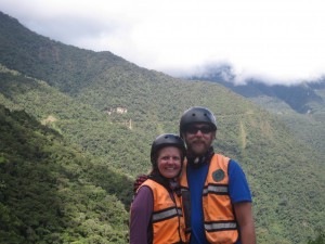
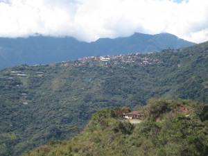
Our first few sections were on the paved highway and descended steeply on fairly wide curves; this gave us a chance to get used to riding our bikes as opposed to riding our brakes. Our views of huge cliffs that dropped off directly below the highway and the valley gorge below us were splendid, although the wrecked bus at the bottom served as a somber reminder that we needed to take care as we rode. Our guide asked us for a team name, and I coined us the Screaming Gringos, and everyone who was not a hoity-toity-19-year-old-British-girl-who-had-gone-on-this-ride-even-though-they-hated- biking-and-the-outdoors-in-general-but- wanted-the-cool-t-shirts-anyway had fun living up to our name as we zoomed down the road and through the small villages high up on the hill.
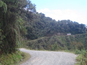
After about 45 minutes of high-speed action on the pavement, we piled back onto the bus for a snack as the driver taxied us up the optional 8 km stretch that almost no one ever does because of both the high altitude and because the heavy bikes are specifically designed to go downhill. Our bus ride took us to the beginning of the old WMDR, where the road became much more narrow and unpaved. It was, however, a beautiful spot for a bike ride.
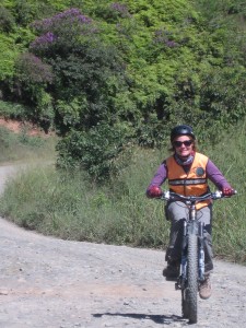
I had never really mountain-biked down technical terrain, so it took a couple of sections before I got used to riding over uneven, loose rocks without riding the brake or tossing off the side of the bike or, more importantly, the giant pit to our left. Once I got it, though, it was fun to bomb down the hill; people were surprised that it was my first time mountain biking, and Sarah and I were always towards the front of the group.
The narrowest part of the road is 3 m and occurs directly under the spouting San Juan waterfalls; there is plenty of room for a bike to manuever it, but I have no idea how buses travelling in opposite directions ever did…I guess often enough, they didn’t. Riding this section was actually not too hard, as long as you took the steep drop right before the blind corner at a reasonable pace. After this section, the road widened and eased up mostly, although I managed to entertain two other members of our group when I misjudged a big bump and then in a panic to avoid a rock wall, accidentally hit the front brake and nearly went over the handlebars…it wasn’t so much the sight of me doing it as the words that were flowing from my mouth that got them.
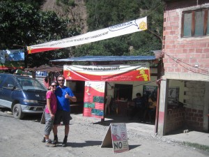
After another hour of riding, we got a glimpse of scenic Coroico in the valley below us; we had dropped almost all of the 3500 m by this point, and both the temperature and the landscape had changed dramatically. We were now in a beautiful green forested jungle setting with a narrow river running below us. After a short break, we rode the last few sections, highlighted by two water crossings on the trail and finishing in the tiny village of Yolossa, which was boiling in the afternoon sun. We had survived the WMDR, and these Screaming Gringos had enjoyed an amazing morning!
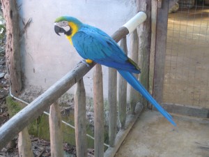
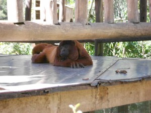
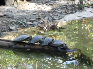
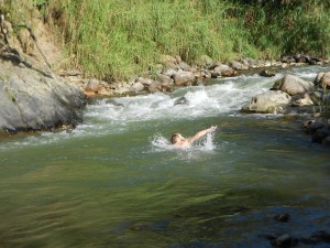
Yolossa is home to a small wildlife refuge that takes in animals that have lost their parents to poaching or that have been abused in some way by their former owners. We had our celebration lunch here, toured the area, and bought a beer and a brownie to support the animals. It was a fun place to visit as we saw several types of parrots, four types of monkeys, a caiman (alligator), and some turtles. There was a natural swimming hole in the river, and so I took the chance to cool off before we headed out.
Gravity is the only company that drives up the road at the end of the day, so we got to relive our glory days on the way home. The valley was very beautiful in the fading sunlight, and our driver treated us to a view over the side at the spot below the waterfalls–we were all glad that no other traffic would be on the road!  While we’ve been fortunate enough to experience more magnificent things than we (well, I) probably deserve over the past 10 months, our ride down the WMDR was one of the best, and I think I’ll start saving my nickels for a mountain bike when I get back home!
After the excitement and adrenaline rush of riding the WMDR, our final day in La Paz was much more calm, but it was interesting to get a little better feel for the city. Even better, both Sarah and I were actually feeling healthy for the first time in quite a while (she had some sort of flu bug during our first day here, and we were both on the tail ends of nagging colds); we were both hoping that this trend would stick around, but for now, we would simply take advantage of our good health.
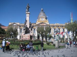
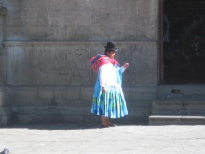
Our sightseeing began with a walk to the formal city center of La Paz, where the massive 1835 cathedral, the Presidential Palace (which I guess has bullet hole in it, but we didn’t see them), and the bright yellow legislative building all surrounded a lively plaza full of Bolivians taking their lunch. It was a good place to people watch as daily life went about itself, complete with old school bus group taxis called micros, food vendors, and women in traditional bright dresses and derby hats. These women usually tend the millions of stands that line the city’s streets; the variety and quirky combinations of goods you can purchase at these stands is incredible. Sometimes, a shop will have 50 bars of soap for sale, while others will sell something like two bars of soap, some candy, and a power drill. Strange.
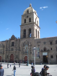
The other place we visited was La Paz’s main landmark, San Francisco Cathedral. Over 460 years old, this massive church now houses a museum in the former cloisters and wine cellars. It gave a pretty good explanation of the Franciscans role in Bolivian history–they were very involved in the revolution that led to Bolivia’s birth as a nation. After checking out some of the old winemaking instruments and the art gallery that focused on St. Francis, we were able to go to the balcony level and take a peek at the church’s interior; it was done in the baroque style that we have seen in most of the churches we’ve visited in South America. We were then allowed to climb up to the bell tower, where we got some stunning views of the city and the hills above us. Most people are accompanied by a guide, but we had talked our way into going up unaccompanied. To reward the people’s trust, Sarah decided to ring the bells, which resounded loudly into the crowded square below us. We made a pretty quick exit, avoiding eye contact along the way.
La Paz was an interesting city; it wasn’t really like any other city we’d seen throughout our travels. It’s crazy setting high up in the mountains and below the rocky cliffs where most of its residents live is a starkly rural contrast to the bustling city right below. Life seems to zoom right through the busy streets, yet many of the locals live the slow life in the plazas and the sidewalk stands. I guess I just liked watching the city live because it certainly is its own entity.



Kudos to Sarah for the bell-ringing. 🙂
Speaking of bell ringing, what´s on my schedule next year, besides 4th period prep.?